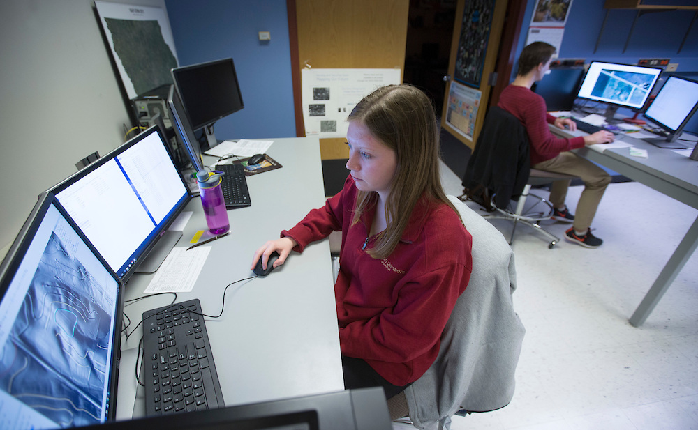
Junior Evann Martin, a community and regional planning major from Cedar Rapids, digitizes farming conservation practices in the GIS facility. Photo by Christopher Gannon.
Attention researchers, administrators, faculty, staff, students or map enthusiasts: The staff at Iowa State's geographic information systems (GIS) support and research facility can visually reveal research results, statistics, numbers and a host of other measurable data using its powerful imaging and mapping GIS software. Robin McNeely, GIS lab manager and analyst, shares insight into the facility and how it's making an impact at the university and throughout Iowa.
The basics
Established: 1991 in the office of the vice provost for research. Today, the GIS facility is administered within the College of Design.
Employees: Two full-time staff, three part-time staff and nine student workers
Location: Research lab is in 218 Durham Center; teaching labs are in 526 College of Design and 248 Durham
Facility hours: 8 a.m. to 5 p.m., Monday through Friday. Walk-ins are accepted, though it's better to make an appointment via email.
What is the function of the GIS facility?
We're here to support the use of geographic information systems for all of campus and beyond by offering access to the GIS software. We also offer help for people who don't know how to use the software or who may want to take tutorials. We can help you get a project started for free, or they can pay us to do project work. If they have data or an idea of what they want to do with their data, but they don't know how to use the software or they don't have time, we can go over the options.
How would faculty or staff use GIS?
GIS is software that does spatial analysis of data. There are people in every college who use it. Anyone who has data that can be placed somewhere on the globe can utilize GIS. Let's say you have data on ISU students who have graduated, and you know what county they came from. The software can take the tabular data of that information and join it by county name to our data set. The software will create a visual map, showing information such as the number of students from each of the counties, the grants they received, or what majors they studied. GIS is good for census data, and there are staff members, especially those in admissions and at the alumni association, who need to look at demographic information.
What makes GIS so powerful?
It's a tool. You just need to know the piece of the tool you want to use and what you want to get out of it. For someone who doesn't know GIS, they think it's like Google or Bing -- you can see a map, you can see town names and roads. That's like high-level GIS. The part that makes GIS more powerful is that there's a whole database behind the scenes. So everything you're looking at, there's a table that contains whatever information you want, and the table and the database are linked. You can query your database and see it visually in a table or you can look at the map and see the data. When you have a table with data, you get a feel for what it says. But as soon as you see it on a map, patterns pop out. To see your data visually opens up a whole new world of things you wouldn't have noticed in a table.
Does the GIS facility offer services beyond the university?
We do contract work for the Iowa Department of Natural Resources, the Iowa Department of Agriculture and Land Stewardship, the Iowa Department of Transportation through our work with Iowa State's Institute of Transportation (InTrans) and many other organizations. We have people and companies come to us from off campus that may not have the staff to complete their own GIS analyses, both private and public. We work with companies throughout the state. Every now and again, I get a phone call from a farmer who needs a map of his property, so we do that type of work for individuals also. If they need significant help, we let them know about our fees for service, printing of maps, shipping of documents, etc. Sometimes lawyers call because they need a certain map from a certain date to prove something. You just never know when the phone rings. It's a job that is almost always something new and interesting.
The GIS facility employees often host "mapping parties" for the campus community. What are they and why do you offer them?
That's the outreach side of us. We like to share and show people that the introduction to GIS isn't that complicated. The mapping parties are related to humanitarian work because there is no GIS data for some countries. The Red Cross, for example, wants to know where there are roads or buildings or open fields so they know where to land a helicopter. We have a day -- very often around Martin Luther King Jr. Day -- when faculty, staff, students and the public are invited to come to the lab and sign up for a free account. We teach people how to use the interface, and they create data. If you can use a mouse and trace something on a photo, you can do it. It's a simple intro to GIS, and people can get a feel for what it's like. And, they might decide they have a need for it in their real lives and look into it.